 LanChile A320 flight from Santiago at Calama's El Loa
Airport
LanChile A320 flight from Santiago at Calama's El Loa
Airport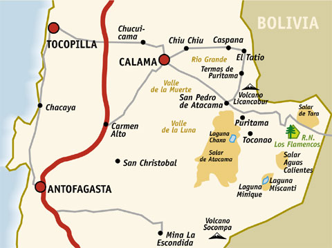
| Nov. 10 | Saturday | Arrive Calama Airport, Taxi to San Pedro de Atacama |
| Nov. 11 | Sunday | San Pedro de Atacama, Valle de la Muerte, Valle de la Luna |
| Nov. 12 | Monday | Salar de Atacama, Altiplano Lakes |
| Nov. 13 | Tuesday | El Tatio, Pueblos Andinos |
LanChile A320 flight from Santiago at Calama's El Loa
Airport
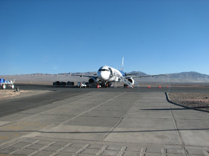
Calama is the gateway to San Pedro de Atacama and the desert beyond. Not an especially interesting city itself, it is the closest airport and that is where we headed hours after we landed at Santiago after the long flight from the US.
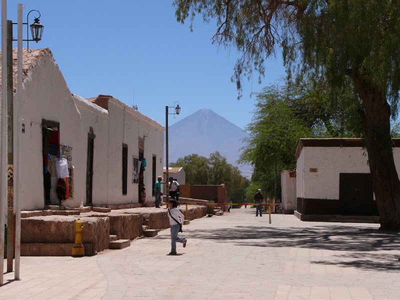 San Pedro de Atacama with Volcan
Licancabur
San Pedro de Atacama with Volcan
Licancabur
Our explorations of the area included the commonly visited sites Valle de la Muerte, Valle del Luna, Salar de Atacama, Altiplano Lakes, El Tatio Geysers and Pueblos Andinos. This is your standard 3 day itinerary. A brief visit to the Padre le Paige Archaelogical Museum on Sunday morning in the village itself completed the essentials. We booked these tours with the same company (Sunday afternoon at Valle de la Muerte, Sunday twilight at Valle del Luna, Monday full day tour of Salar de Atacama, Altiplano Lakes, Socaire and Toconao, Tuesday early morning at El Tatio Geysers and a full day tour of Pueblos Andinos before returning to Calama on Tuesday night and catching our return flight to Santiago on Wednesday morning.
We did not choose to explore the other options: Puritama Hot Springs, Tara Salt Lake Tour, Pukara de Quitor.
Valle de la Muerte (“Death Valley”) is a deformation of the name Valle de Marte (“Mars Valley”), which comes from the “martian” (reddish) color of the earth and the outlandish topography. This valley is part of a flamingo natural reservation and lies inside the Salt Mountain range.
It is a somewhat hidden valley and system of dunes and small caves a few kilometres from San Pedro, on the North East side of the road to Calama. To get to it you cross the Salt Mountain range, and it made for an interesting hike afternoon through an outlandish landscape.
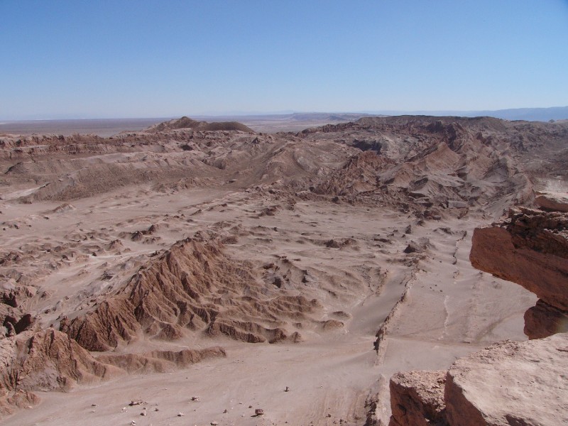
Valley of the Moon is a fantastic moon landscape that is a part of the Cordillera de la Sal (Salt Mountain Range) belonging to the Los Flamencos National Reserve. It is a large depression in the ground, 1,650 feet (500 m) in diameter, that exhibits odd sculptural shapes. These are the result of a sequence of transformations on the earth's crust caused by the folding of the watery ground underneath the salt lake.
Because of its lack of humidity, there is little life here, and it is one of the most inhospitable places on the planet.
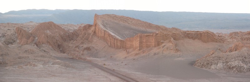
We reached Valle de la Luna (16 km. from San Pedro) at sunset and climbed a large sand dune to watch odd shapes cast long shadows. The waning sunlight intensifies the impression of a moonscape. This was also a great place to watch Licancabur again.
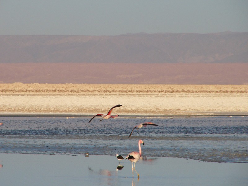 Flamingoes at the Salar de
Atacama
Flamingoes at the Salar de
Atacama
The Altiplano (Spanish for high plain), where the Andes are at their widest, is the most extensive area of high plateau on earth outside of Tibet.
In the case of the Andes, it is an area of inland drainage lying in the central Andes, occupying parts of Chile, Argentina, Bolivia, Peru and Ecuador. Its height averages about 3,300 meters (11,000 feet), somewhat less than that of Tibet. Unlike the Tibetan Plateau, however, the Altiplano is dominated by the massive peaks of active volcanoes to the west. The Atacama Desert, the second-driest area on the whole planet, lies to the southwest of the
Altiplano.
Laguna Miscanti is a brackish water lake
located in the altiplano. Miñiques volcano and Cerro Miscanti
tower over this lake. This heart-shaped lake has a deep blue color. The western shoreline of the lake is separated by less than 1 km from the drainage divide between the lake and the Salar de Atacama basins.
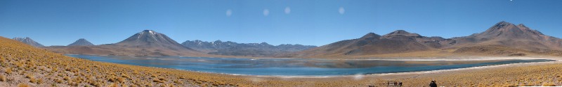
A lava flow from an eruption of Miñiques separated Laguna Miscanti from Laguna Miñiques and surrounded them with white banks.
Laguna
Miscanti
The lakes are part of one of the
seven sectors of Los Flamencos National Reserve
and are flamingo breeding sites.
On our return to San Pedro, we stopped for a quiet afternoon exploration of the village of Toconao (38 km. from San Pedro) which is at 2475m above sea level. It is an oasis, whose sweet waters, free of arsenic, allow for the cultivation of a variety of fruit trees such as pears, plums, quince and grapes as well as a large amount of vegetables. This pre-Hispanic settlement has an interesting architecture in local liparita stone, which is volcanic soft and white stone, extracted from a quarry 2 km. up the local street.
Geyser El Tatio lies within the Tatio geothermic basin and is located around 90 km north of San Pedro, very close to the border with Bolivia (within 5 km.). At over 4300 meters elevation (14173 ft.) it is one of the worlds highest geyser fields and consists of a vast field of fumeroles. The fumeroles are formed when frozen underground rivers make contact with hot rocks and steam escapes to the surface through fissures in the earth crust, some reaching up to a height of 10 meters.
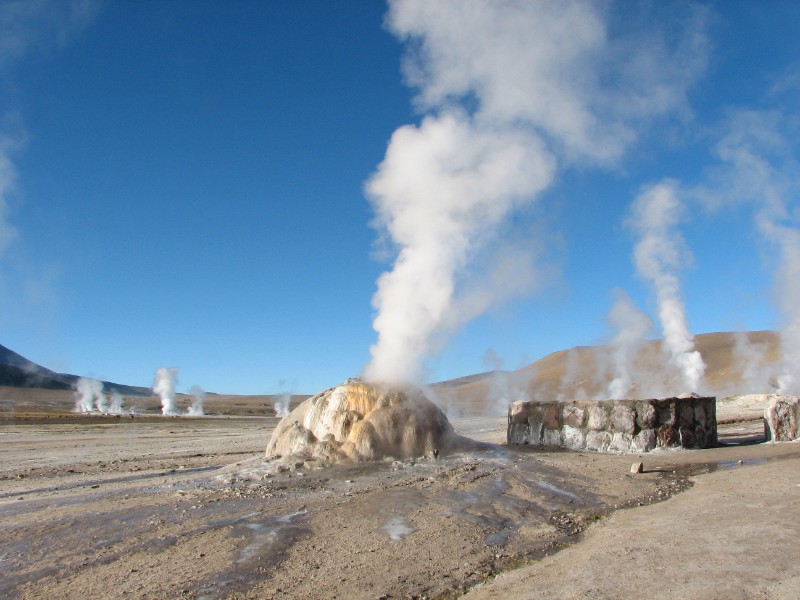 Geothermal activity at El Tatio Geyser
field
Geothermal activity at El Tatio Geyser
field
While it is less dramatic than Yellowstone, the visual
impact of its steaming fumeroles at sunrise is quite dramatic. We took a tour
that left San Pedro at 4:00 a.m. to get there at the break of
dawn
. There are also some hot water springs that have
been made into thermal baths. To our surprise, there were no restrictions on
wandering around on the geyser field, something that would never be allowed in a
US national park.
Pueblos Andinos - Andean Villages. This route stretches the El Tatio expedition into a full day exercise. It is also a convenient way of returning to Calama as part of a tour. The tour bus returns to San Pedro for those wishing for a return to San Pedro.
The
scenery on the route from El Tatio through the villages is breathtaking.
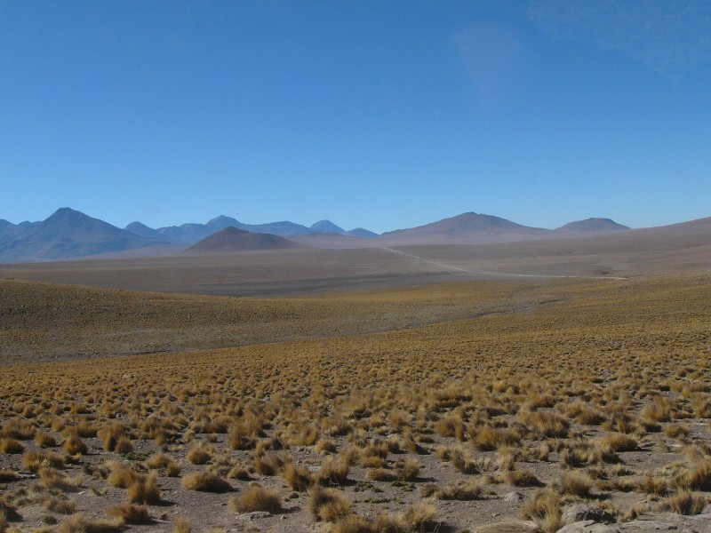 High desert landscape enroute from El Tatio
through the villages
High desert landscape enroute from El Tatio
through the villages
Apart from views of Salar de Atacama, there are several high mountain peaks that keep the route interesting. Caspana is a quiet picture-perfect village the way. A brief stop at Lake Chiu Chiu, a look at some pre-historic petroglyphs and then the last leg to Calama going right past the mining town of Chuquicamata , rounds off the long day.
| Atacama Photo Album |  |