|
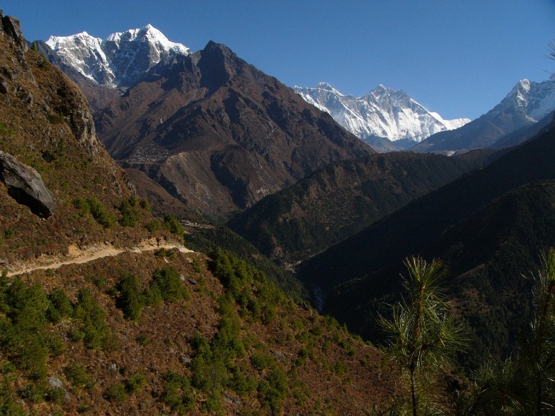
| The town of Phortse can be seen center-left (below Tawoche peak). The Dudh Kosi river can be seen in the shadow below. It splits into two at Phunki Tenga (seen bottom-center exposed to the sun) where the Dudh Kosi veers left towards Gokyo and the Imja Khola veers right in the general direction of Mount Everest. And finally, we can see the steep switchbacks (center) exposed in the sunlight, that has been cut on the mountain directly above Phunki Tenga which eventually becomes a long stretch from left to right. The Tyangboche Monastery is also in the picture as a tiny speck on the top of this mountain (directly below Lhotse Shar). |
 |
| Camera: Panasonic DMC-FZ10 | Date: 10/24/08 8:43 AM | Resolution: 2304 x 1728 | ISO: 100 | Exp. Time: 1/1300s | Aperture: 5.2 | Focal Length: 6.0mm (=36mm) |
| Total images: 18 | Help |