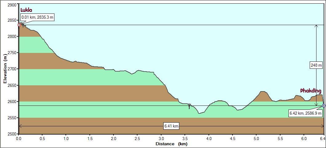
Starting
point : Lukla (Altitude: 2835m/9290ft. Start Time: 9:50 am)
End point :
Phakding (Altitude: 2586m/8487ft. End Time: 1:15 pm)
Distance: 6.4
km./4 miles
Net
Elevation Gain/Loss : -250m./800 ft.
Everest Base Camp 2008 - Day 1
|
Starting
point : Lukla (Altitude: 2835m/9290ft. Start Time: 9:50 am)
|
The first day's walk is a short 3 hour descent to Phakding. Still in the lower elevations, the route followed the Dudh Kosi river staying to the right of it. Going downhill made it an easy walk. A little worry cloud (we'll have to climb back to Lukla after 13 days of trekking) formed but was easily dismissed.
There was the occasional small bridge across a stream, but the route did not cross the river. The first mile gave us a hint of what lay ahead. Lots of trekkers, cattle (mostly dzopke , a yak-cow hybrid) and porters carrying impossibly heavy loads (some > 100 kg.). The initial section of the route could hardly be called a trail. It was more like a highway (with foot traffic only) with residences and lodges lined up all the way. The mountain sides were a lush green. Manis (stone mounds with religious symbols in Tibetan script decorated on the outside) were frequently encountered and we kept to the left of these structures as is prescribed in the Tibetan religion.
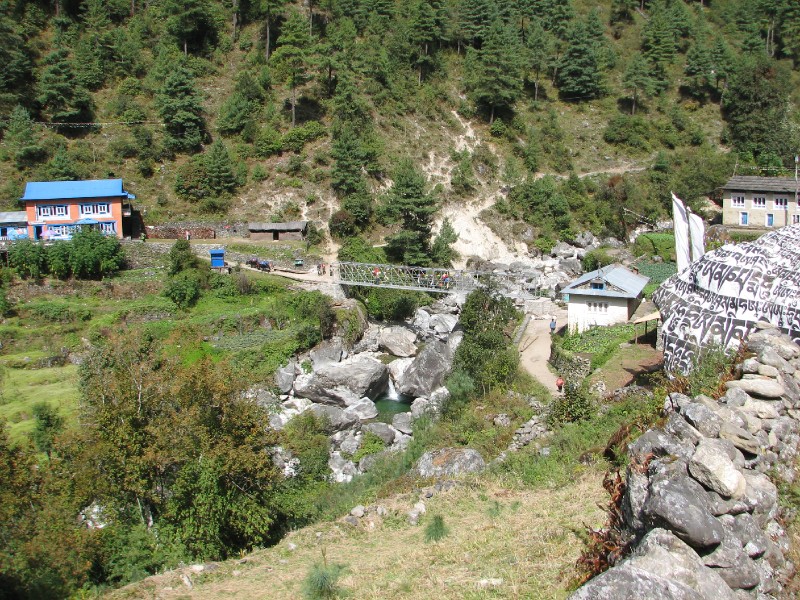 Small bridge crossing and
Mani (middle-right)
Small bridge crossing and
Mani (middle-right)
Up ahead, in front of us, was a high snow-covered peak (Kwangde Ri at 6178m) which we would keep seeing for the next few days till we got so far ahead of it that we would eventually lose it behind us. This would be a pattern throughout, the opportunity to see a mountain from many perspectives - south face, sideways directly beneath and north face. Before we reached our destination for the day, we could view two more high mountain peaks, Kusum Kanguru (6367m) and Thamserku (6623m).
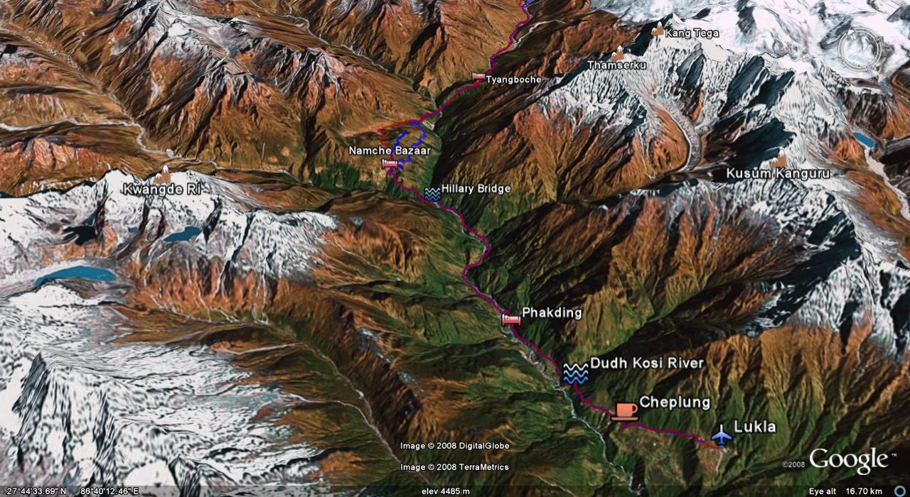
The route for the first 2 days from Lukla to Namche Bazaar : This perspective shows the nearby high peaks (Kwangde Ri at Left and Kusum Kanguru, Thamserku at right. Kang Tega would only become visible on Day 3 after we passed Namche Bazaar.s
The above graphic shows the 3 mountains which play hide and seek from deep below in the Dudh Kosi valley. Once we get to Namche Bazaar on Day 2 and reach 3400m, these mountains will stay visible from the trail.
While we could have had lunch at Phakding, our guide stopped at a restaurant on the way (Thado Kosi ) for lunch (Dal Bhat and Veg), our first big meal on the trek. It was very wholesome and fulfilling. We happily walked downhill another hour to reach Phakding .
We got a room with a great view of the Dudh Kosi river at the See You Lodge. We could hear the rushing waters all night.
In the afternoon, we learnt some more about the Guide's duties. Dinner order is taken well in advance in the afternoon with serving time as well. It is invariably served earlier. The Guide brings the menu to us, takes our order. The serving is done by the lodge staff and the guide. This was a repeating pattern throughout the trip. We did, on occasion, try and get things ourselves but such attempts were usually directed to the guide. Much of this was due to the fact that cost of the lodging and meals were borne by the company and it is the guide who manages that budget.
We chatted with a lone trekker who was just finishing up a 20+ day itinerary and listened to his experiences. We were curious as to what lay ahead. He warned us that we should expect lodges uphill to get full earlier in the day as there were not that many. For now, we were alright as Phakding and Namche have plenty of lodges. The lodges don't handle advance bookings and only provide accomodation on the day of arrival. Of course, there are fallback options like dormitories, renting tents etc.
| <--Prev |