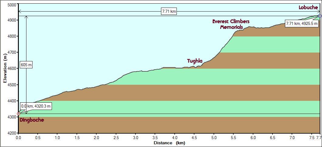
Starting
point : Dingboche (Altitude: 4320m/14175 ft. StartTime:
8:25 am)
Endpoint : Lobuche
(Altitude: 4925m/16160 ft. End Time: 12:30 pm)
Distance
: 7.7 km/4.8 miles
Net Elevation Gain/Loss
: 605m/1985 ft.
Everest Base Camp 2008 - Day 7
|
Starting
point : Dingboche (Altitude: 4320m/14175 ft. StartTime:
8:25 am)
|
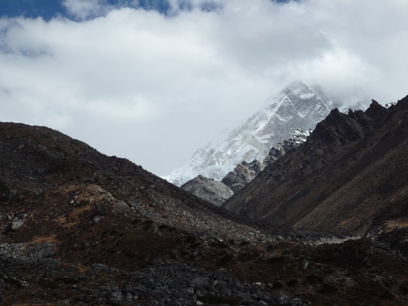
After six bright and sunny days, we woke upto a cloud covered day on the seventh. It did not make any dent on the scenery. On the contrary, the mountains were more clearly defined in this light and looked even more imposing (see pic below). The path to Lobuche stayed on the ridge that we saw from the Nangkartsang trail the previous day. Understandably, it was much colder and we had extra layers on top and bottom with the hood on our windproof jackets up. Felt safe, like being in a house. We were now well above the treeline and the landscape was quite barren.
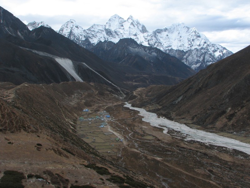 Kang Tega and Thamserku
over Pheriche by the Khumbu Khola river
Kang Tega and Thamserku
over Pheriche by the Khumbu Khola river
After walking for an hour, it started snowing very lightly. But it did not last long.
Panorama enroute to Lobuche from Dingboche
Having disappeared after a sneak preview on the way to Dingboche 2 days ago, Pumori revealed a lot more of itself.
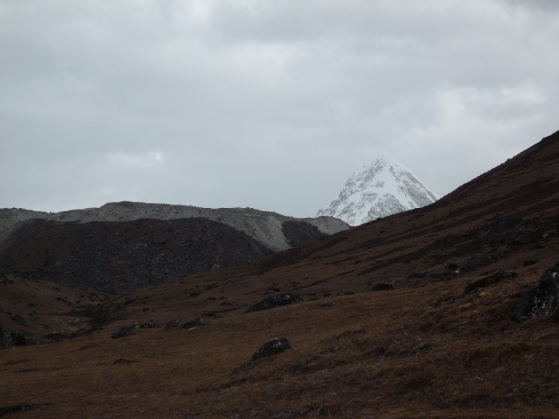 Pumori
Looking back, the vista was breathtaking as Ama Dablam had now joined forces with our old friend Kang Tega now forming the southern backdrop. We were at 4600m. elevation approximately. That is Venkatesh in the red jacket below to keep the wind and cold out.
 Ama Dablam and the Kang
Tega range (looking south)
Ama Dablam and the Kang
Tega range (looking south)
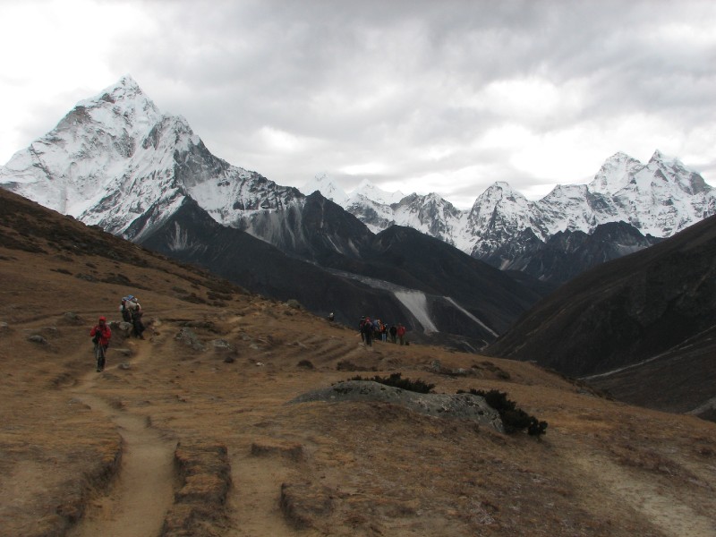
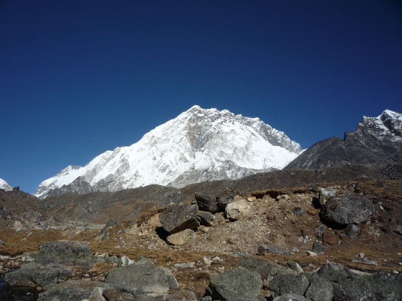
We made our first encounter with Nuptse even though much of it obscured by clouds. Nuptse (7841m/ 25726 ft.) is (like Lhotse) part of the same mountain system as Everest. It happens to be the edge of the wall that obscures Everest to viewers from the south. Several photographs of Everest have Nuptse for company sometimes looking deceptively taller. Its rank in the list of the highest mountains in the world is No. 19.
 At last we see
Nuptse
At last we see
Nuptse
After crossing the Khumbu Khola river we arrived at Tughla (just one lodge and restaurant) which is at a crossroads. A trail forks here to go over the forbidding Chola pass to Gokyo Ri on the other side (see map in the Overview page). We broke here for tea. After Tughla, the route climbs steeply for 250m. The picture below shows this steep stretch and the video shows the zombie like pace of trekkers as they slowly make their way up.
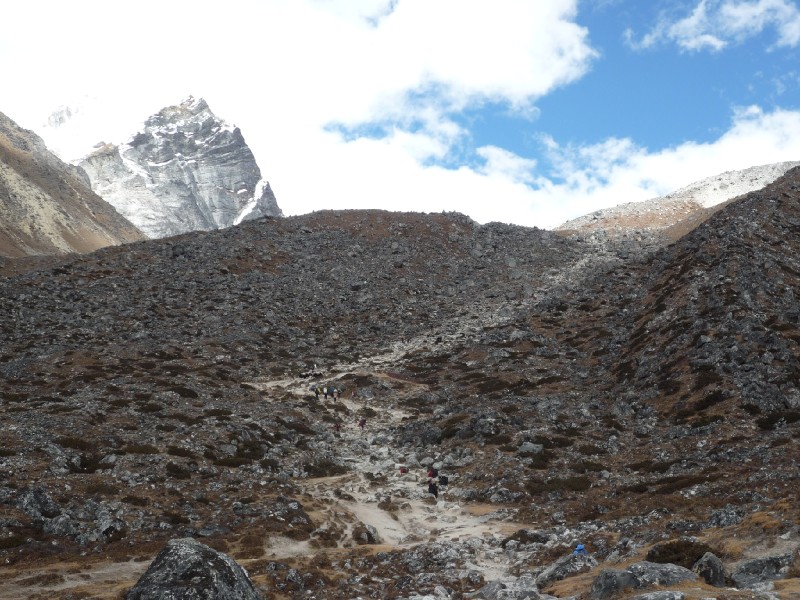
The steep stretch was very slow going due to the altitude (> 4600m) and it took us 45 minutes to get to the top. This is where a memorial to those who perished on Mount Everest exists. The memorial to Babu Chiri Sherpa contains an inscription that mentions his astounding records (a. Climbed Everest twice within 2 weeks, b. Stayed 21 hours on top of Mount Everest without auxiliary oxygen and c. Fastest summit of Everest in 16 hours 56 minutes). He climbed Everest 10 times but perished on the 11th attempt.
 The Memorial (Ama Dablam,
Kang Tega and Thamserku in background)
The Memorial (Ama Dablam,
Kang Tega and Thamserku in background)
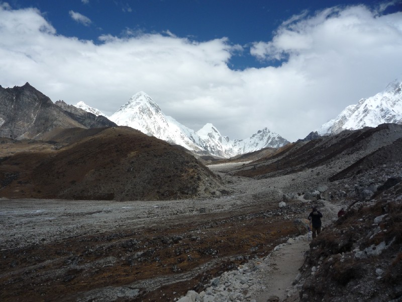
In a little while, we saw the Khumbu Glacier. For the rest of our trip to Everest Base Camp, this glacier would accompany us. Initially it is just a river of rocks.
 Khumbu Glacier with
Pumori in the background (left)
Khumbu Glacier with
Pumori in the background (left)
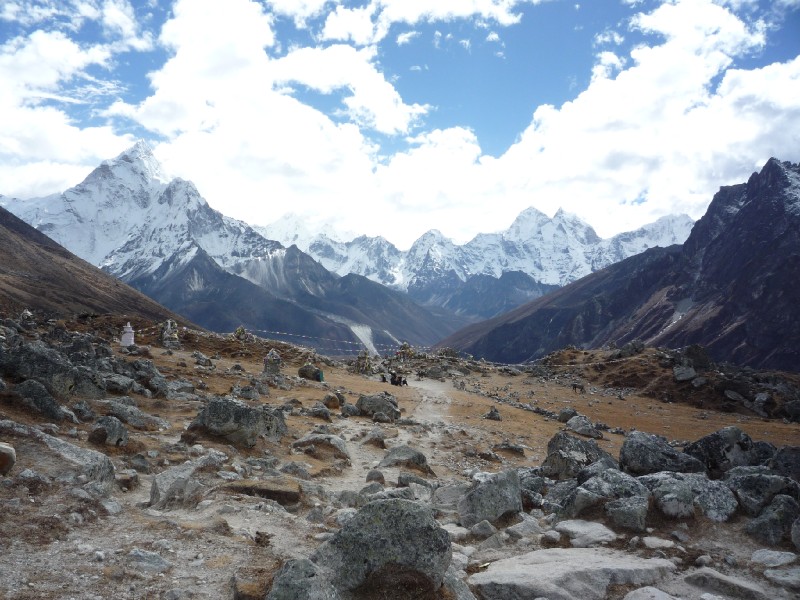
A short while later, we saw the handful of lodges that make up Lobuche. For the first time on the trip, we had a problem as all the lodges are full ("packed" is the term used by our guide and porter). Well, not quite. We were escorted to a ramshackle building as our thoughts go wild ("if the lodges are all packed, what is this then? Is it some kind of animal shelter where we will be given a corner?"). We took a look at what can be best described as a wooden box, just the size of 2 beds just narrowly separated for some legroom. There was no window (which was a big letdown for us, who have been spoilt with views of Everest and Ama Dablam the previous three days!). Fearing that it could only get worse, we accepted and moved in. As we settled in, we heard other trekkers who arrived even later than we did and had been brought in to view the rooms at this lodge (Kalo Pathar Lodge). It was amusing to hear their unseen reactions and we could see the funny side of our own horrified reaction to the rooms just a little while ago. Fortunately, the lunch at the lodge was a very tasty Veg. Fried Rice.
We spoke to a pair of Polish women who had just returned after climbing Kala Patthar earlier that day. It was sad to hear that the clouds had completely obscured any views and they did not get to see the expected Everest view. Their schedule was quite tight and they could not have waited another day. That was a great pity, to have come halfway around the world and walked all these days. Of course, we just needed to view it from the larger perspective. The Khumbu Valley is not just about Everest. There are several experiences to be had with Everest being just one of them. We had extra days in our schedule in case we got shut out by the weather on a given day.
After 2 pm, the sun came out shining. Nuptse could be seen clearly from outside where a sharply crisp cold breeze was blowing.
 Nuptse (19th highest
mountain on earth)
Nuptse (19th highest
mountain on earth)
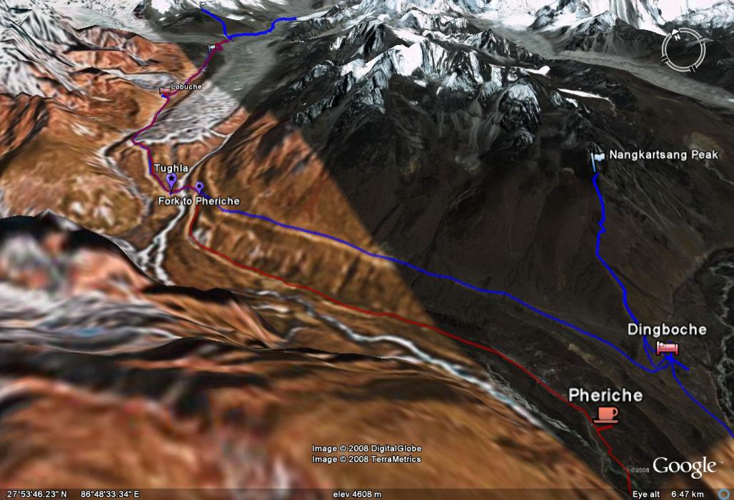
Day 7 path in Google Earth: The blue path is the onward route to Lobuche we took. The red path is the return path to Pheriche that we took on Day 10.
| <--Prev |