
For panoramic vistas of the icefield and the peaks around it and to spot bighorn rams and eagles, the Wilcox Pass Trail offers an easy hike. The trailhead is a short 5 minute drive from the Icefields Chalet.
After making arrangements for the guided icewalk for Day 3, we hiked the trail and were rewarded with views of the surrounding mountains, more bighorn rams than we could count or photograph and finally a view of the Athabasca Glacier from above.
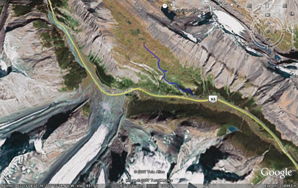
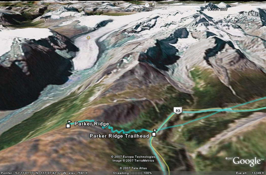
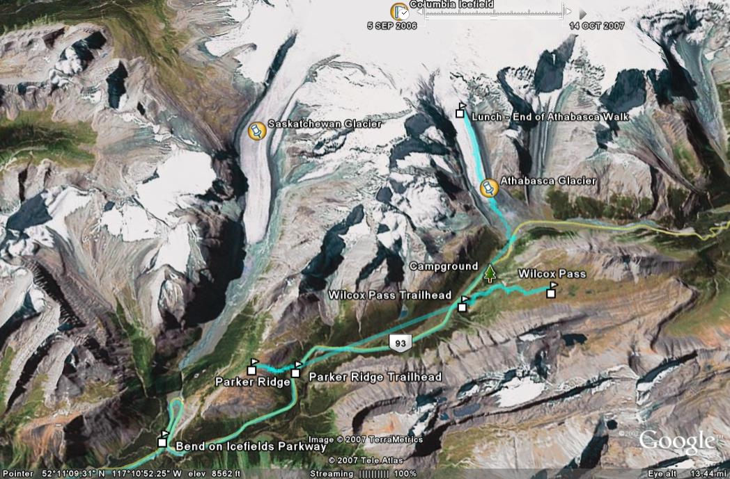
The below Google Earth snapshot shows the path of the trail.
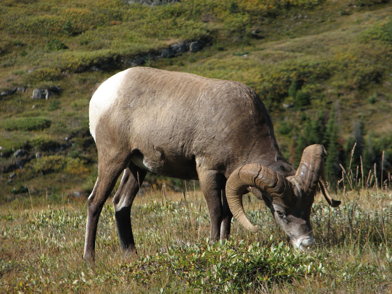 Big
Horn Ram
Big
Horn Ram 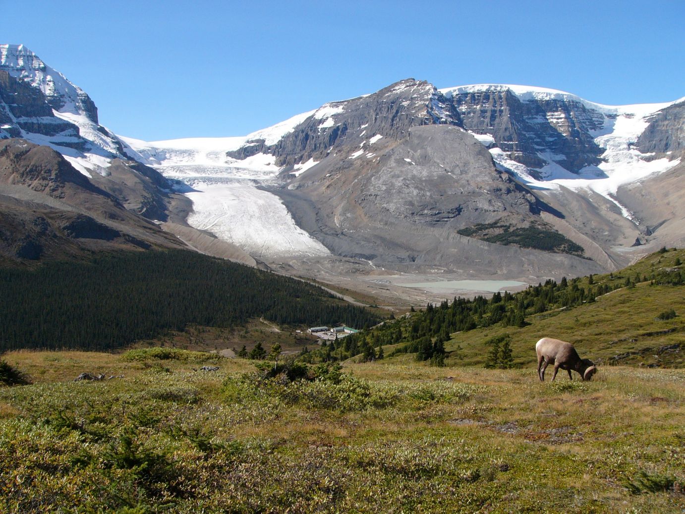 Athabasca Glacier from Wilcox pass trail
The below snapshot provides the aerial view of the trail (the blue path is the trail and the yellow path is the parkway)
After a short break for lunch, we turned back to the trailhead and then drove further down to the Parker Ridge trailhead.
Unlike the Wilcox Pass Trail, the Parker Ridge Trail does not offer any treats on the way. It switches back and forth as you climb over the parkway. After 40 minutes of this, you cross a ridge and within a few minutes spot the Saskatchewan Glacier and walking further on you can see the Saskatchewan River sourced by the glacier.
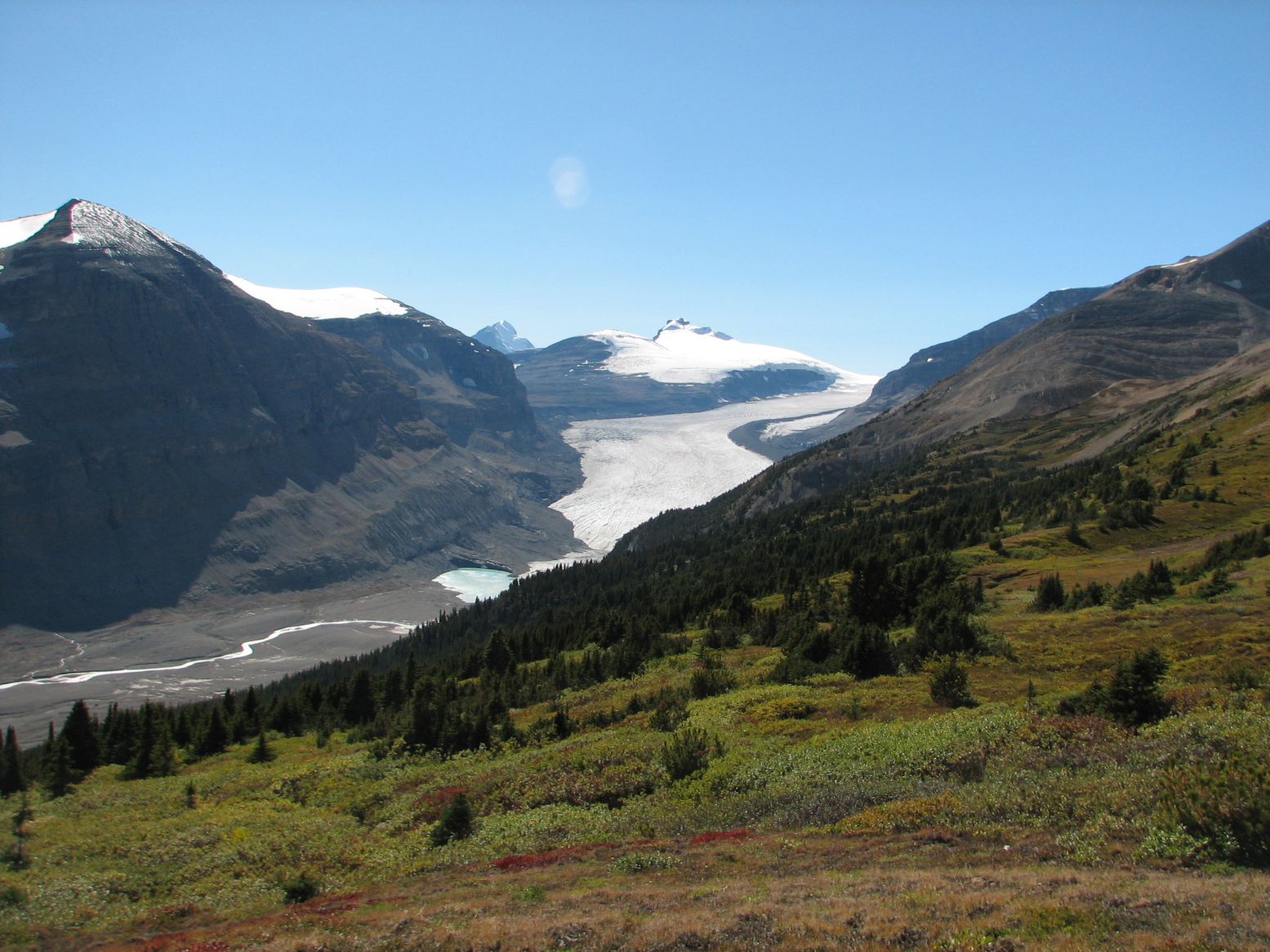 Saskatchewan Glacier and Saskatchewan River.
Coming back down to the highway by 4:30 pm, we still had enough daylight for a drive north to Athabasca Falls, stopping at Sunwapta Falls on the way.
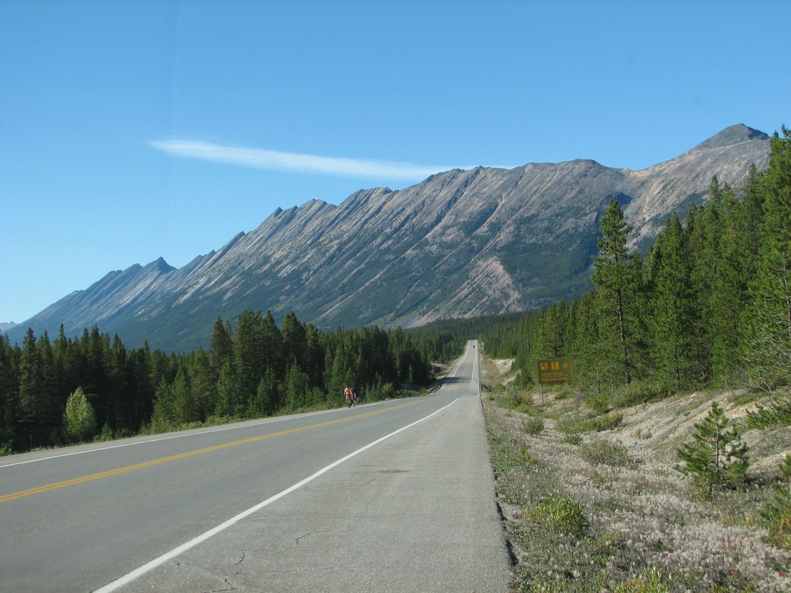 |
Icefields Parkway in the Jasper National Park stretch north of Columbia Icefield |
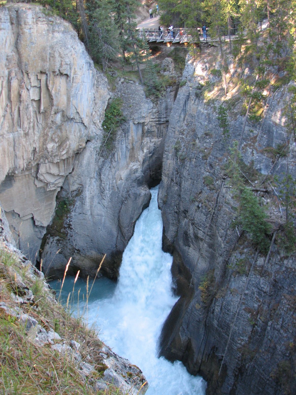 |
Sunwapta Falls which actually originates from the Athabasca Glacier. |
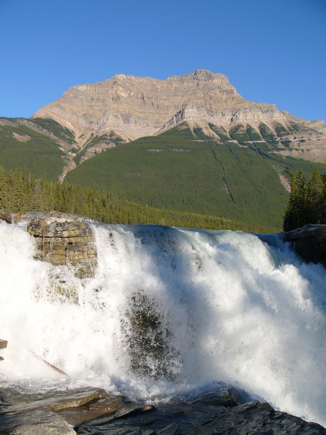 |
Athabasca Falls |
 |
The profile of the Parker Ridge Trail. From the parkway, the switchbacks on the mountain side takes the hiker past the ridge for a magnificent view of Saskatchewan Glacier. |
The following Google Earth snapshots provide an idea about the Columbia Icefields area and the two hikes completed on Day 2.
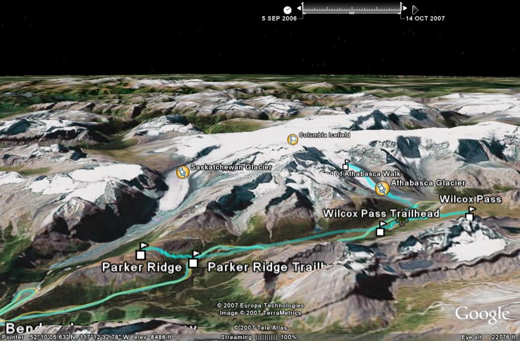 |
The Columbia Icefield (center) with the 2 Glacier arms, Saskatchewan (left) and Athabasca (right). The two trails (Wilcox Pass and Parker Ridge) provide viewpoints of the two glaciers. The Icefields Parkway spans from bottom left across the lower part of the picture. |
 |
An Aerial view of the 2 trails covered on Day 2. |
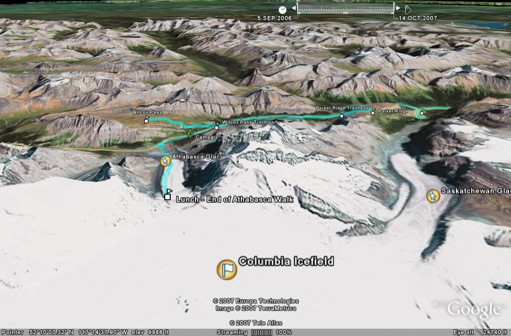 |
The same as seen from the point of view of Columbia Icefield. |
Related links to the descriptions of the hiking trails...
http://www.onedayhikes.com/Hikes.asp?Hikesid=132
(Wilcox Pass Trail)
http://www.onedayhikes.com/Hikes.asp?HikesID=131
(Parker Ridge Trail)
Click here for the full album of Day 2.
Photos & Text : Malini Kaushik & R. Venkatesh