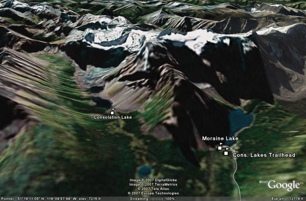
Moraine Lake is a short drive from Lake Louise and is renowned for its unique blue color. Our plan was to complete a short 2 hour hike to Consolation Lakes before enjoying views of the lake. This was going to be a short day as we had to drive back to Calgary to catch the evening flight back home.
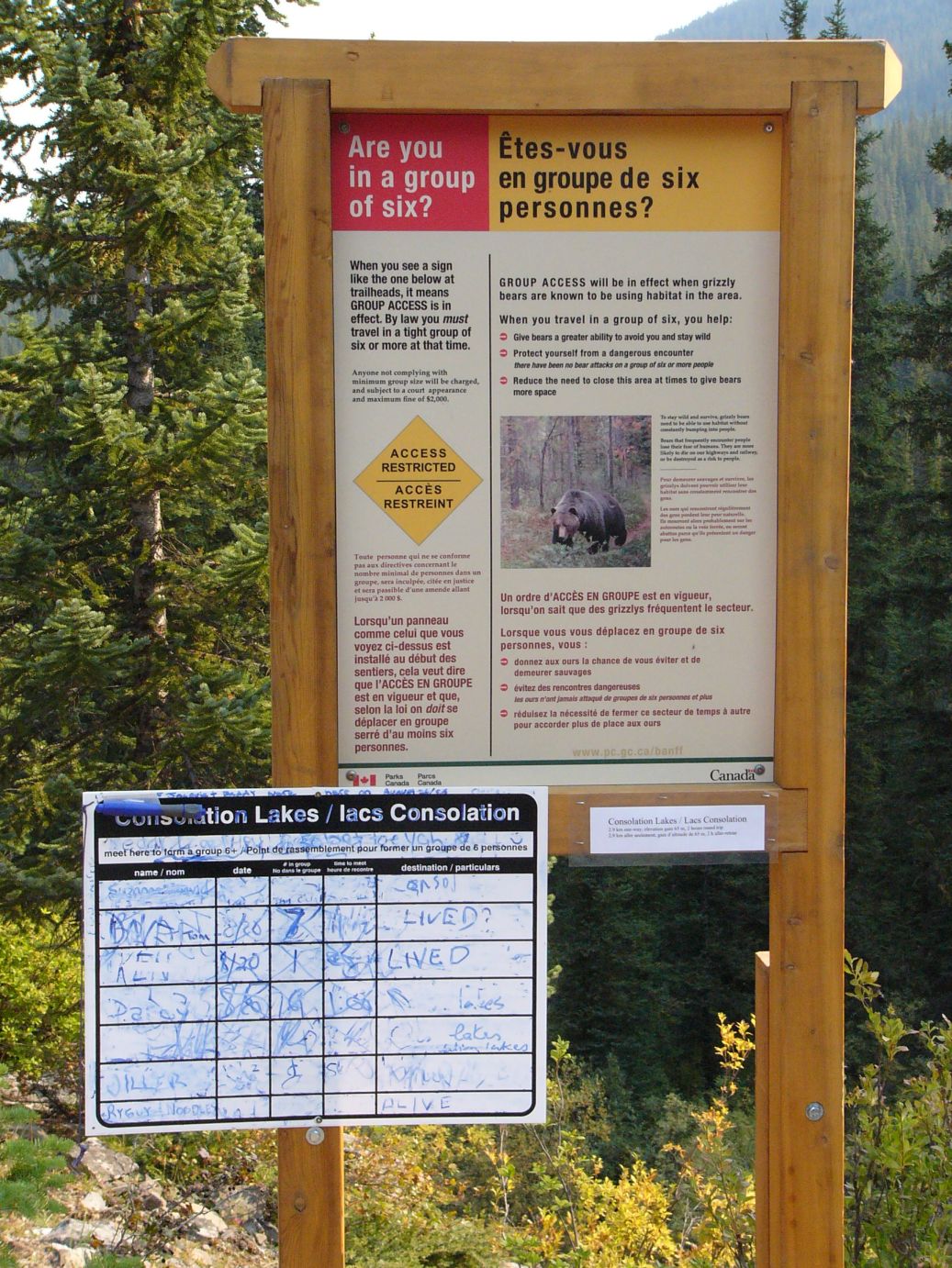
Some excitement was generated by the signs posted outside the Consolation Lakes trailhead that informed us that the group rule was in effect due to heightened bear activity along the trail. We were only 4 and had to wait a few minutes for more people to show up to form an impromptu group.
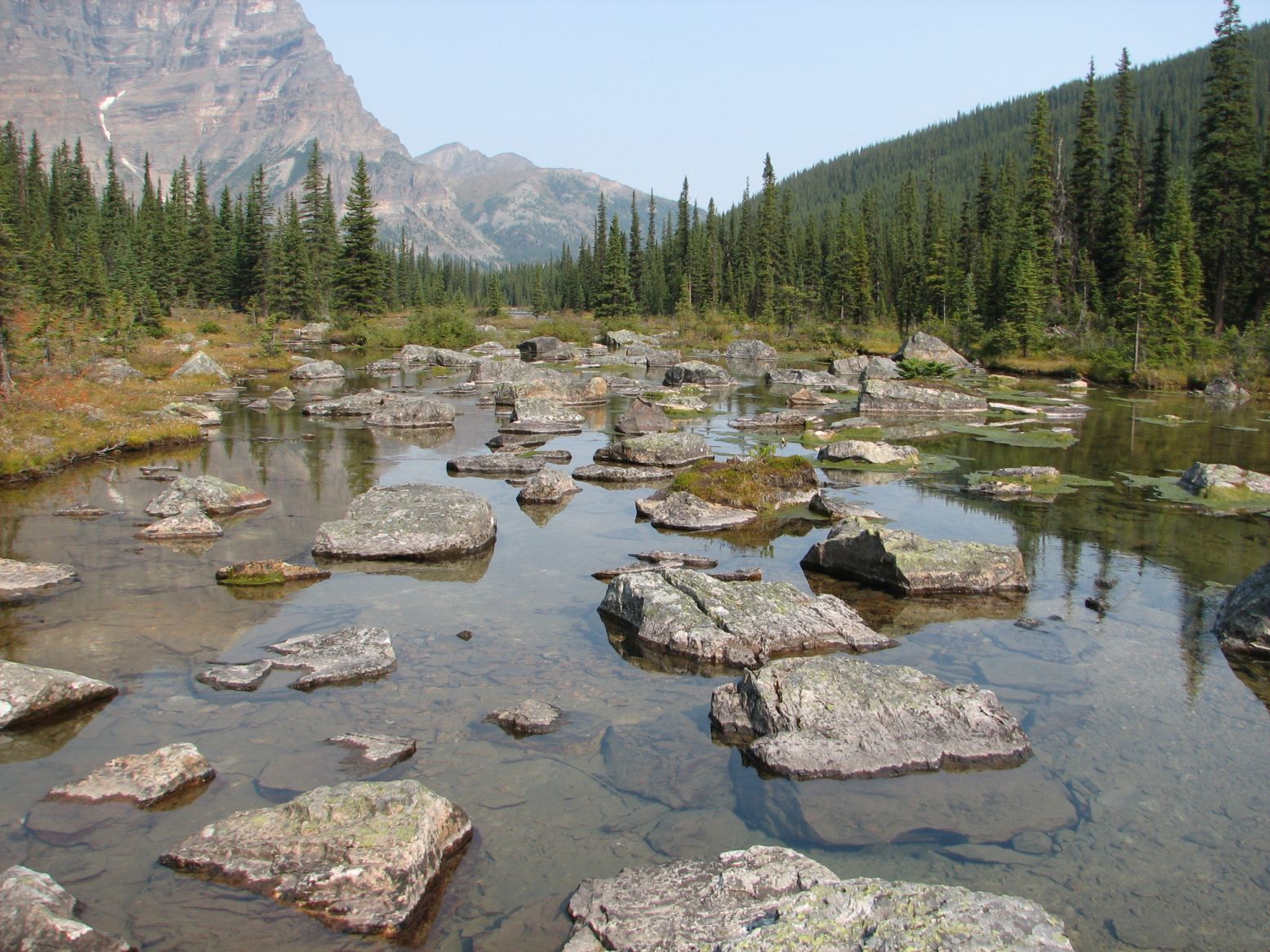
The hike itself was uneventful which was disappointing to some of us. The Consolation Lake area offered a few moments of quiet relaxation sitting on one of these rocks...
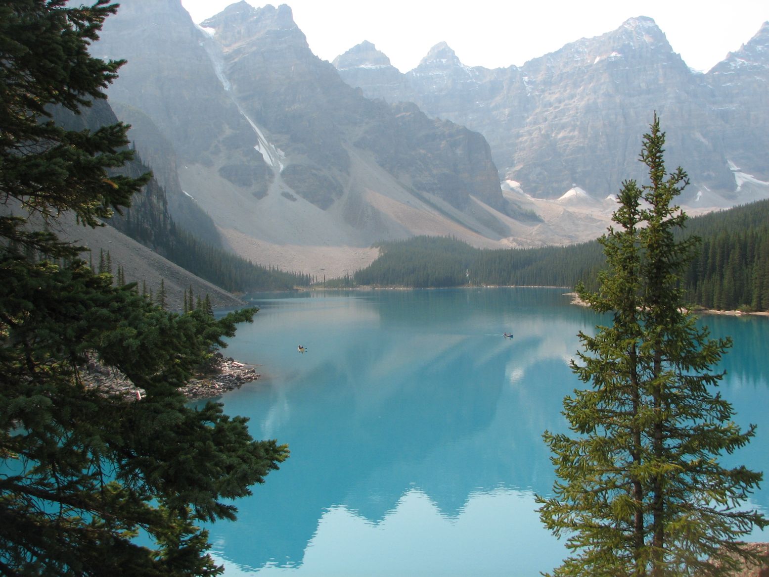
On our return, we stopped by the shore of Lake Moraine for this view of the lake and the Wenkchemna peaks...
...a video of the same...
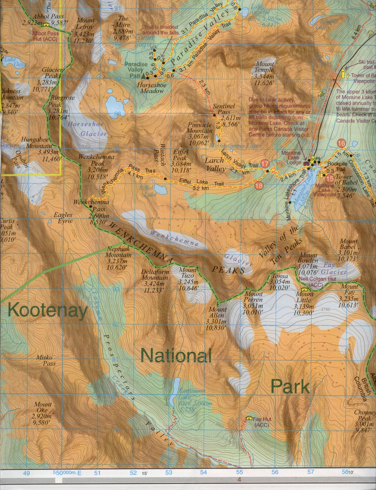
Topographic map of the Moraine Lake area below...Moraine Lake is at middle right. The Consolation Lakes trail is just inside the map at middle right. The Wenkchemna peaks seen in the picture above reflected in the water are detailed with names in the map. Finally, the map below also provides a link to the previous day's hike - the Abbot Pass Hut is at top left. Yet another detail is that the Wenkchemna peaks form the border (the green dotted line) between the States of Alberta (Banff National Park) and British Columbia (Kootenay National Park). The straight green line that runs towards bottom left forms the boundary between Kootenay and Yoho National Parks (both within British Columbia).
Google Earth view of the Moraine Lake area...looking at the Wenkchemna Peaks.
Click here for the full album of Day 5.
The following Google Earth snapshot provides an overview of the route covered during this trip.
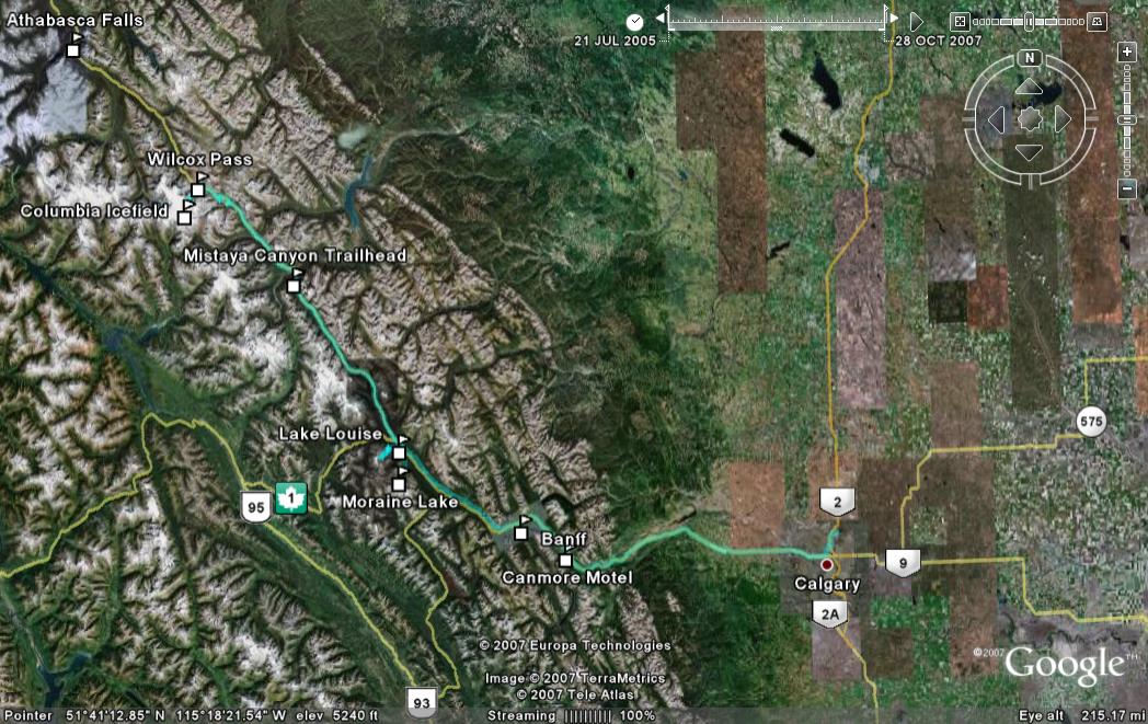
Click here for the Google Earth KMZ file that covers the entire trip.
Photos & Text : Malini Kaushik & R. Venkatesh