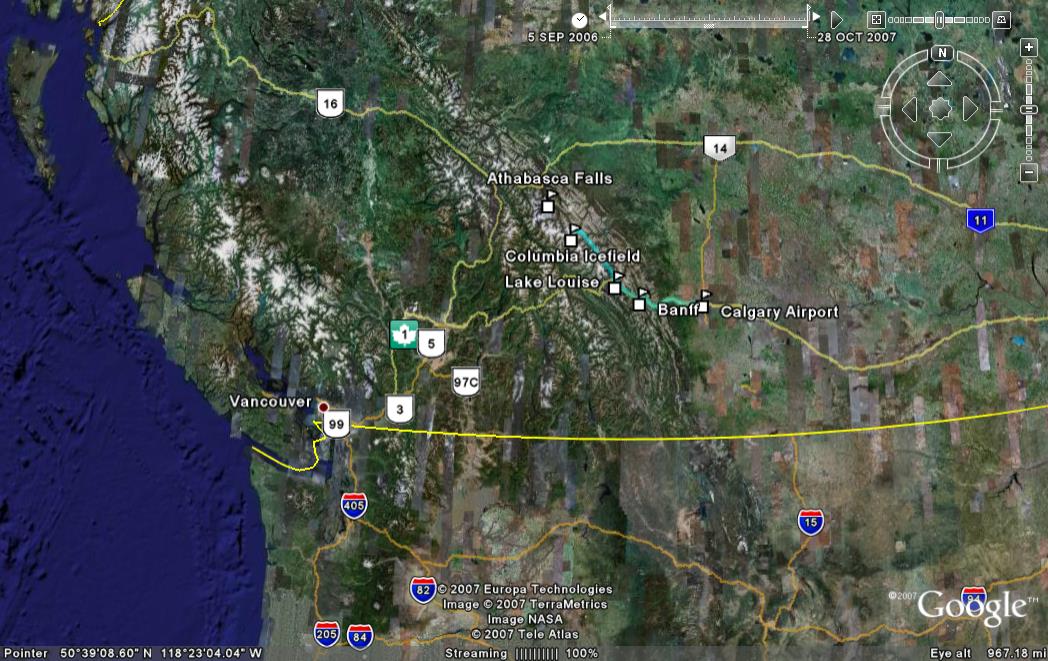
The Canadian Rockies extend in a northwesterly direction continuing on from the border of Alberta and the US State of Montana (which marks the twin parks of Waterton Lakes, Canada and Glacier National Park, USA), straddling the states of Alberta and British Columbia. Several Canadian National parks lie within the Canadian Rockies - Banff, Yoho, Kootenay, Jasper. Unlike the National Parks that we'd seen before (mostly in the USA), some of these parks include residential towns like Banff and Jasper. However, this doesn't detract from the stunning beauty of the snow clad mountains the turquoise blue lakes. The Trans Canada highway 1 (seen in the Google Earth image below marked by the white maple leaf against green background icon) links the southern section of the parks to the city of Calgary (whose airport is called Calgary-Banff).
On entering Banff National Park, the speed limit on the highway drops from 110kph to 90 kph. Warning signs are posted cautioning drivers about animals crossing the highway. Special bridges have been built to help animals cross the highway.
Banff is the largest town in any North American National Park. It was born and built to be a mountain resort and it absorbs the magnificence of the surrounding scenery gracefully. The Bow River snakes around the town and even drops a few feet over an incline forming Bow Falls, which lies behind the historic Banff Springs Hotel. The natural 47.3°C hot springs high on the slope of Sulphur Mountain above the town were the first reason this area was set aside for Canada's first National Park in 1885. The Sulphur Mountain is also the site of the famous Banff Gondola that takes visitors to the top for stunning views of the town and the surrounding mountains (Cascade, Rundle, Norquay, Tunnel Mountain) and lakes (Vermillion lakes close to the town and Lake Minnewanka a little bit away).
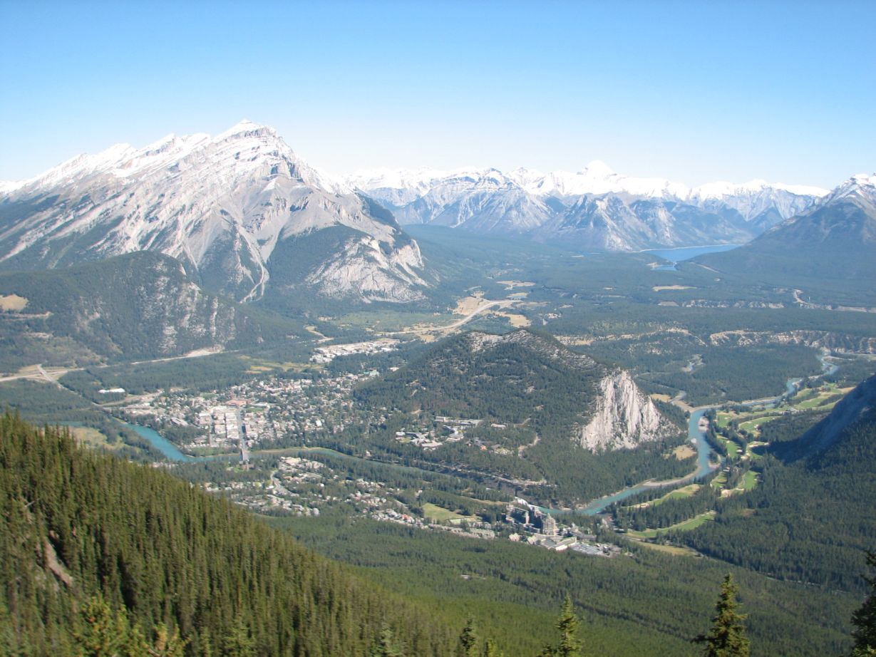 |
View of Banff from the top of Sulphur Mountain (Cascade Mountain looms large at left, the Bow River snakes around town, the small Tunnel Mountain next to the town and the distant Lake Minnewanka can be seen) |
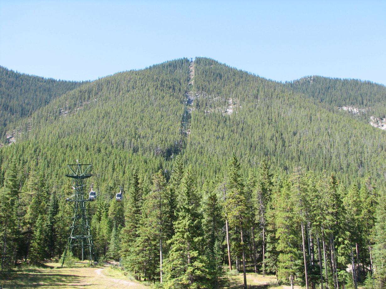 |
The path of the Banff Gondola cut into Sulphur Mountain. At the top is a a viewing area and a small pathway leading to another viewpoint and historical marker. |
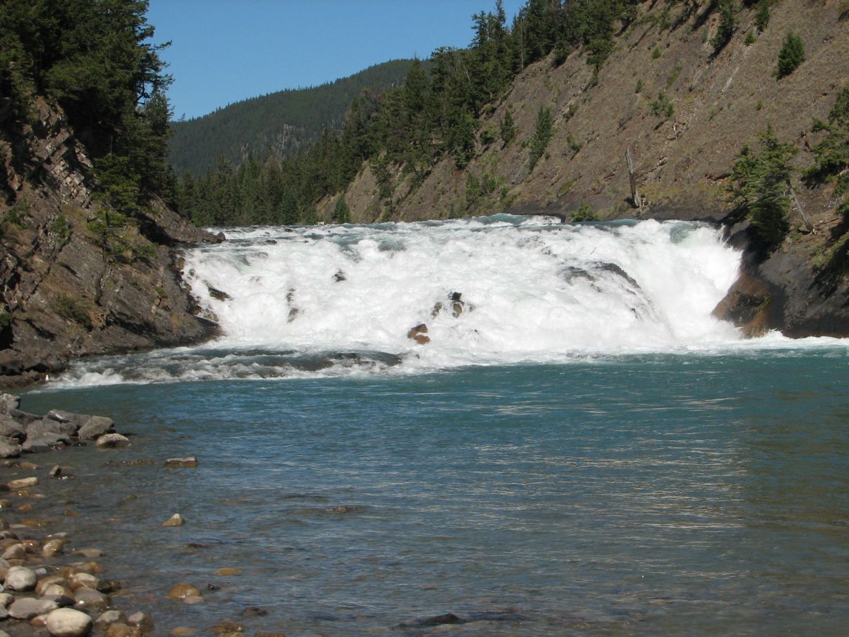 |
The brief but quaint Bow Falls. |
An hour's drive north of Banff lies Lake Louise Village and ski area. The road forks here as the Trans Canada Highway turns left and goes over Kicking Horse Pass into Yoho National Park (British Columbia). Continuing northwest is the Icefields Parkway. It is a 230km/143 mile tour of the Continental Divide that travels past snowy peaks, rock flour fed lakes, spectacular waterfalls, river crossings and wildlife.
After a brief stop for lunch at Herbert Lake just off the fork, we continued on the Icefields parkway, stopping at various scenic viewpoints (Crowfoot Glacier, Bow Lake, Bow Glacier, Mistaya Canyon Trailhead, Saskatchewan River crossing) that appear in quick succession. The Peyto Lake viewpoint is accessed by a trail that climbs briefly. Mistaya Canyon is also accessed by a short trail from the parkway.
After crossing the Saskatchewan river, the parkway curves in a broad circle and then ascends steeply towards Columbia Icefield. This 325 sq. km/125 sq. mile icecap feeds rivers that flow into the Pacific, Atlantic and Arctic Oceans. The icefield has 8 tentacles, one of which is the Athabasca Glacier that reveals itself to even the most casual driver on the parkway. Visitors to the Icefield can explore this glacier through a snowcoach tour or a guided icewalk.
We ended Day 1 by checking into the campground opposite the Athabasca Glacier, the closest glacier to a highway in North America.
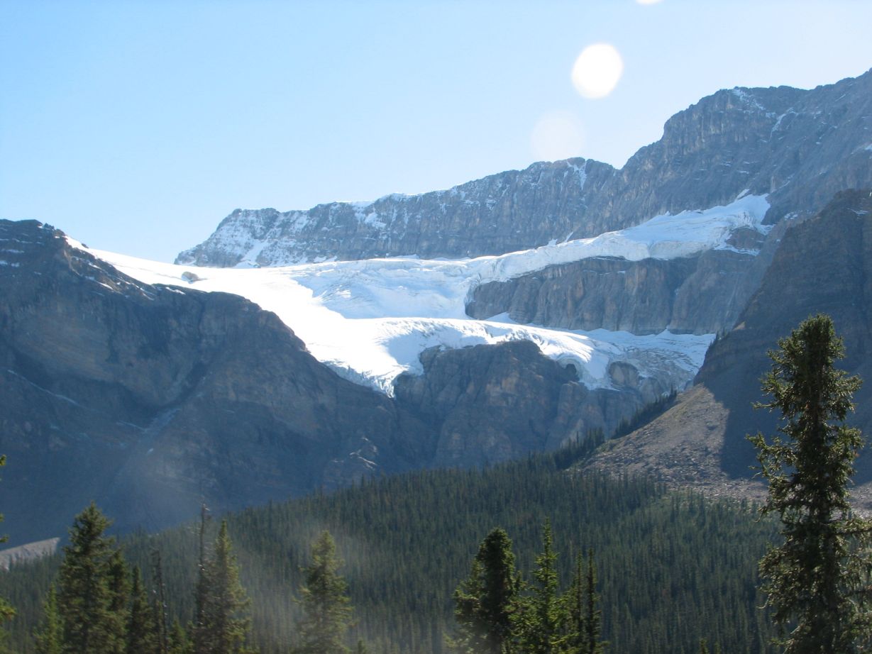 |
Crowfoot Glacier. So called because of the resemblance to talons. The third talon has disappeared over time. |
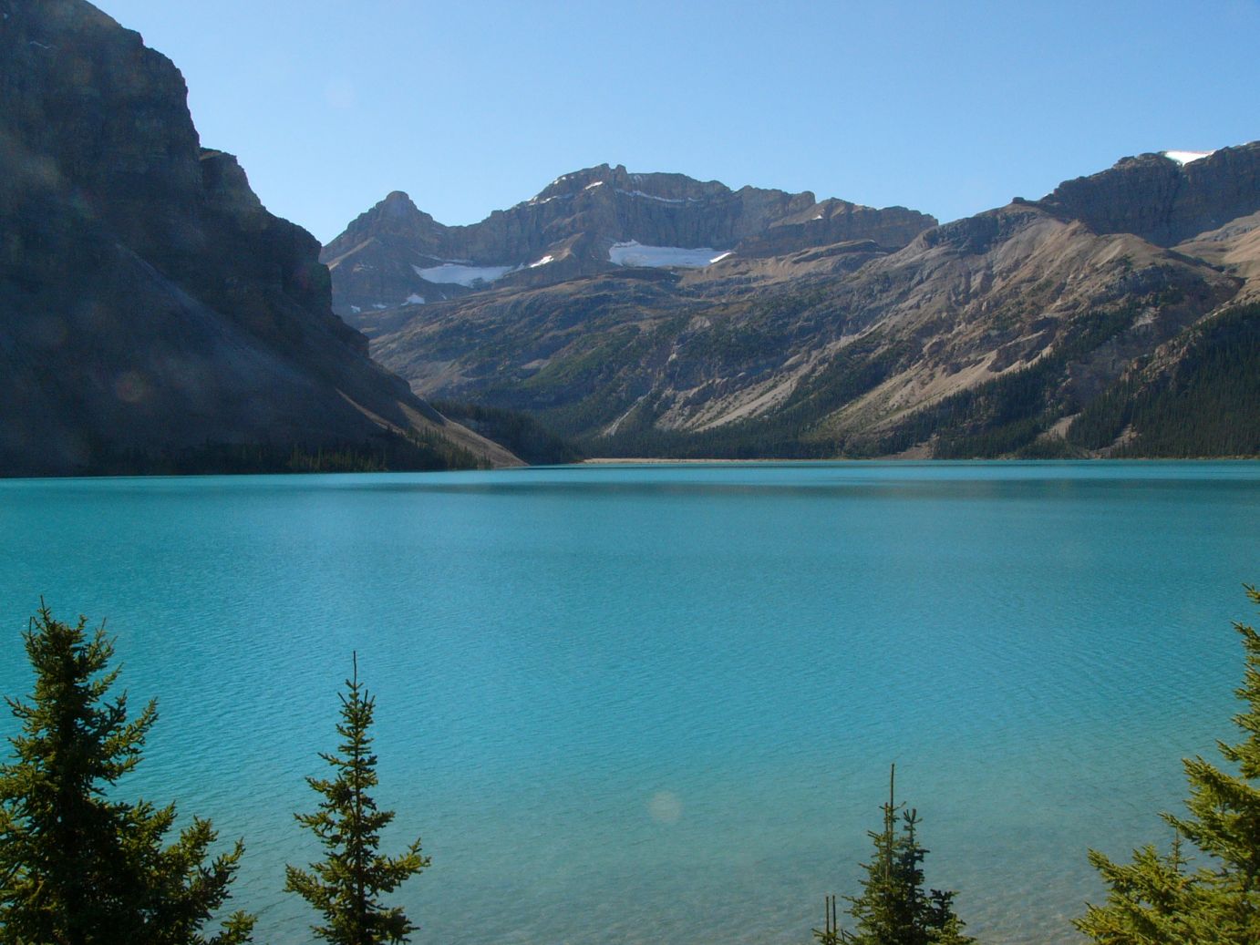 |
Bow Lake. On our return to the area on Day 4 we stopped for a look at the same lake in the morning light. |
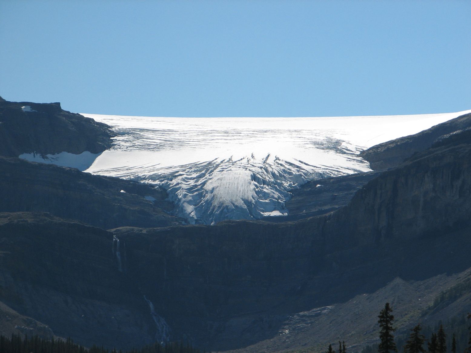 |
Bow Glacier |
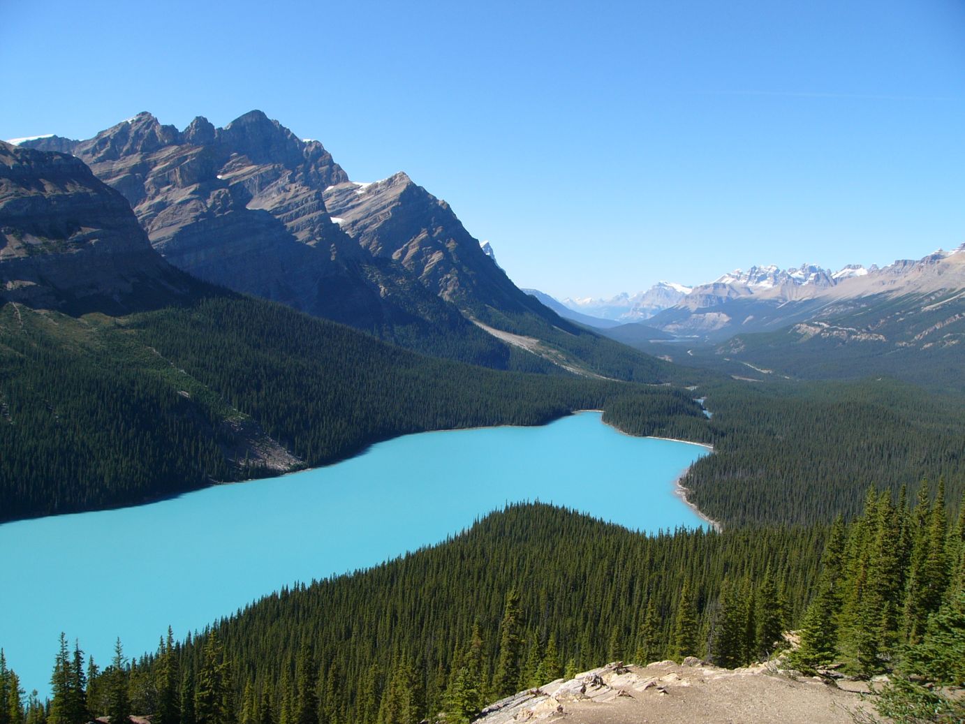 |
Peyto Lake. Glacier fed (with rock flour), the suspended rock particles give the lake this color. This is taken from Bow Summit, the highest point (~7000 ft.) on the Icefields parkway. It snowed here on June 21, 2003 during a previous visit. |
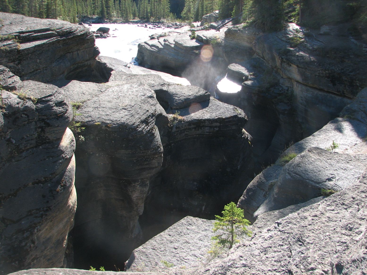 |
Mistaya Canyon |
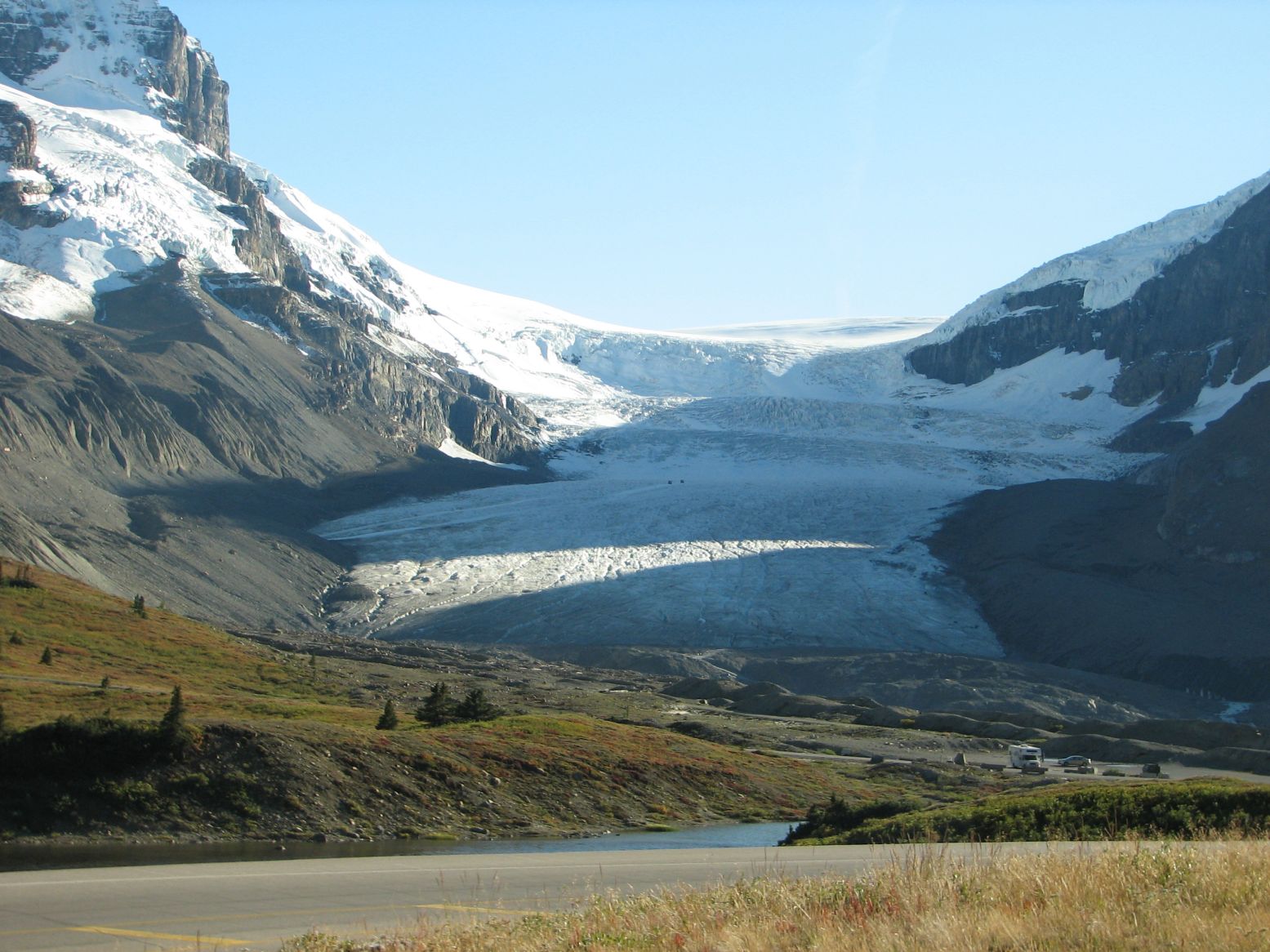 |
Athabasca Glacier, right next to the parkway. |
Click here for the full album of Day 1.
Photos & Text : Malini Kaushik & R. Venkatesh