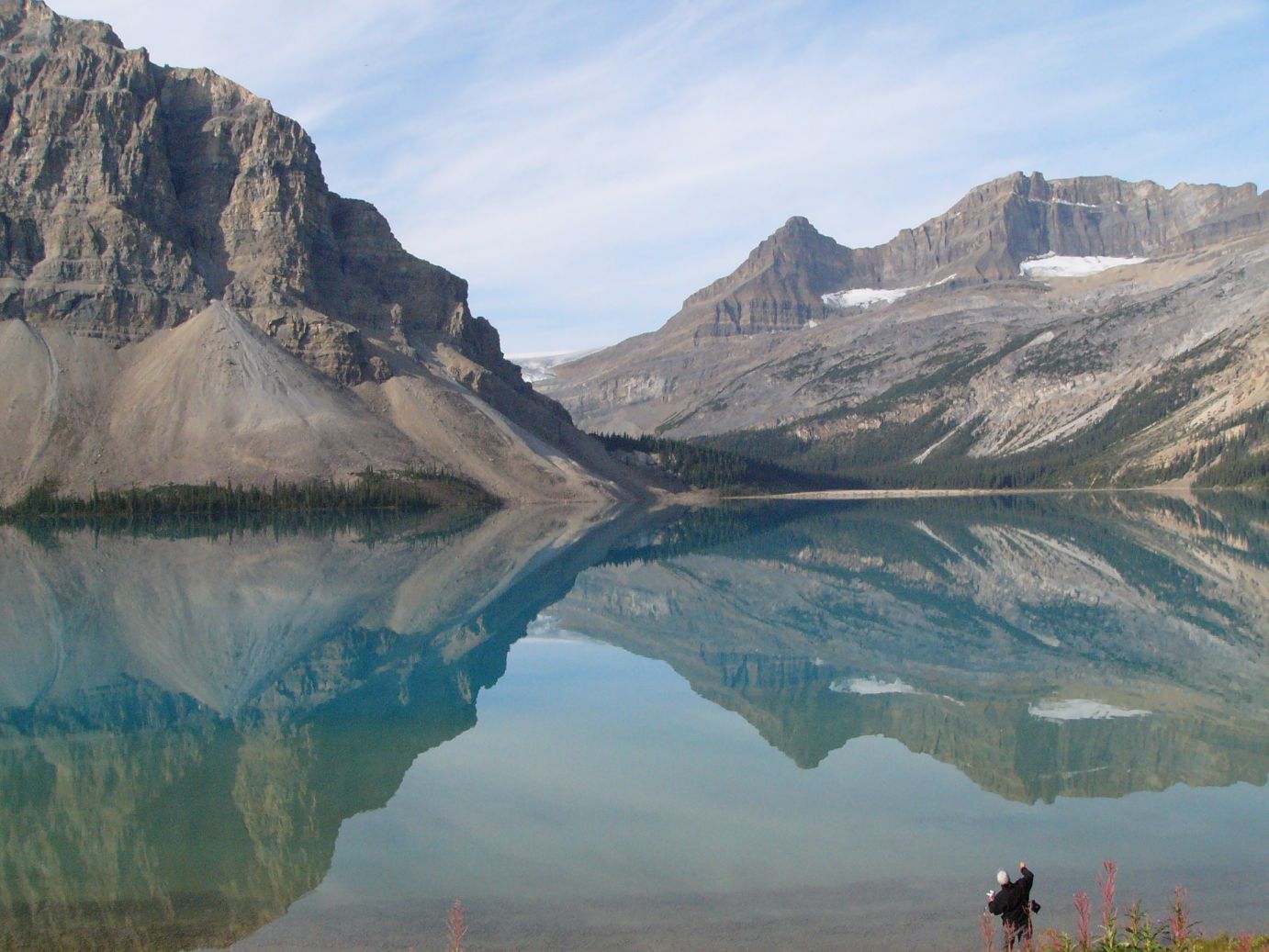
The morning drive from our campground opposite Columbia Icefield to Lake Louise was breathtaking as exemplified by this image on Bow Lake.
After quickly checking in at the Lake Louise Campground, our plan for the day included the strenuous combination of two trails - Lake Agnes-Little Beehive and the Plain of the Six Glaciers trail, a combined length of 12.5 miles round trip.
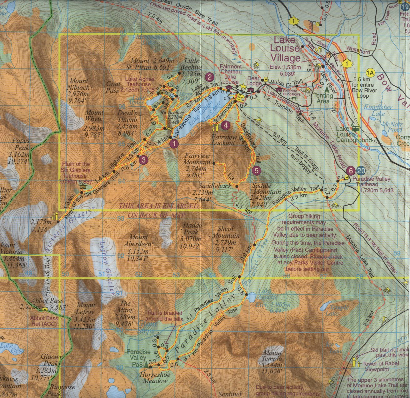
The topographic map below provides fine details of the route. Starting off at the Fairmont Chateau Lake Louise, skirting the lake on the Lake Agnes Trail, climbing a thousand feet to Mirror Lake, then a detour to Little Beehive to take in views of Lake Louise and surroundings. Retracing back and around the nearby Lake Agnes, then climbing again to the top of Big Beehive Mountain. This completes the first hike.
Resuming after lunch on the Highline Trail which eventually catches up with the Plain of the Six Glaciers trail, which stretches straight along a topographic line. A welcome coffee break at the teahouse leaves the final stretch that is less than a mile. The trail dead ends at the steep wall at the foot of Mount Victoria. The reward includes the sight of the glacial moraine (indicated by the little triangles below) and a glimpse (darshan?) of Abbott Pass Hut (named after Philip Abbot, who died in 1896 while attempting to summit Mount Lefroy) through the steep glaciated gap called The Death Trap. And then the long way back on the same trail but without any more climbs.
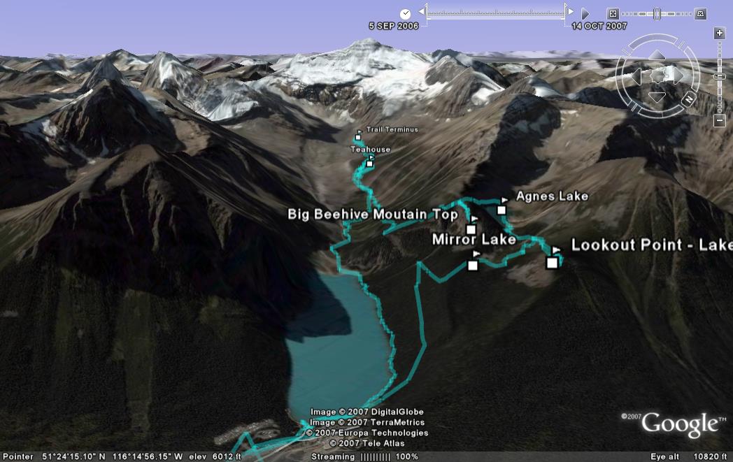 |
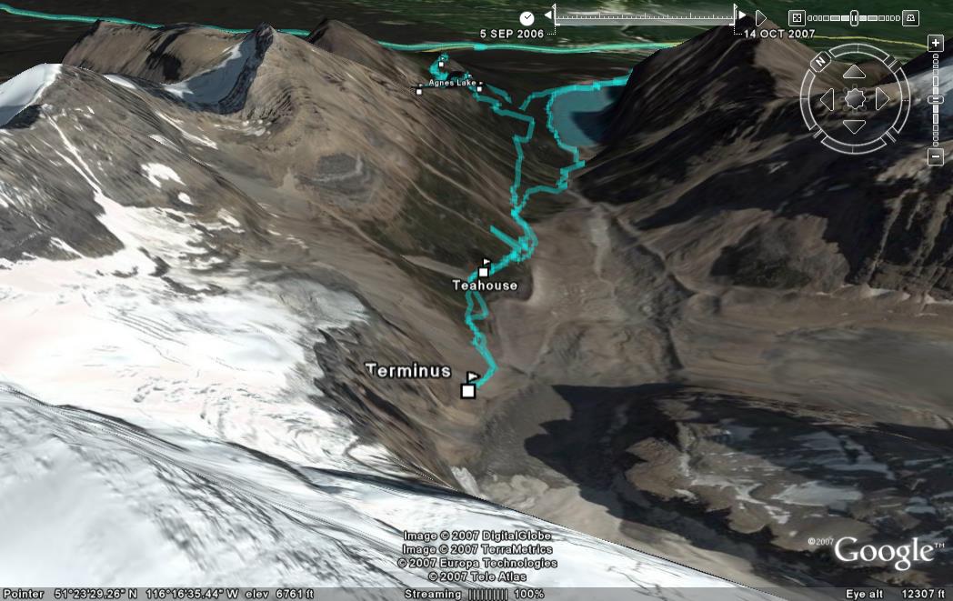
Google Earth overview of the day's route with Lake Louise and the base of Mount Victoria as the two end points. |
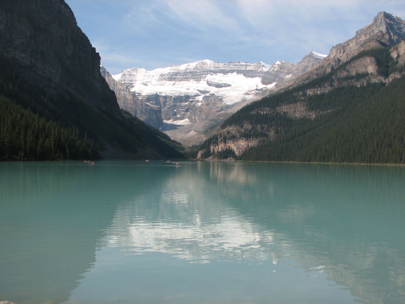 |
Start: Lake Louise with
Mount Victoria in the distance where the day's hike will take us.
|
 |
Google Earth view of the initial part of the trail, showing Mirror Lake and Agnes Lake and the detour to Little Beehive (where it says Lookout Point). The trail goes counterclockwise around Lake Agnes and then climbs to Big Beehive Mountain, before going down the other side. |
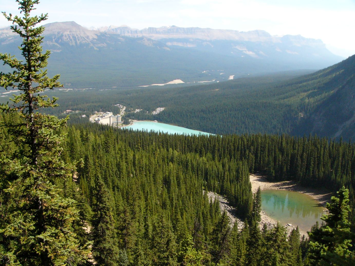 |
From a Lookout point mentioned above: Mirror Lake (1000 feet higher than Lake Louise), Lake Louise and Chateau and the Bow River Valley and mountains |
 |
Lake Agnes and the hikers switching back over it |
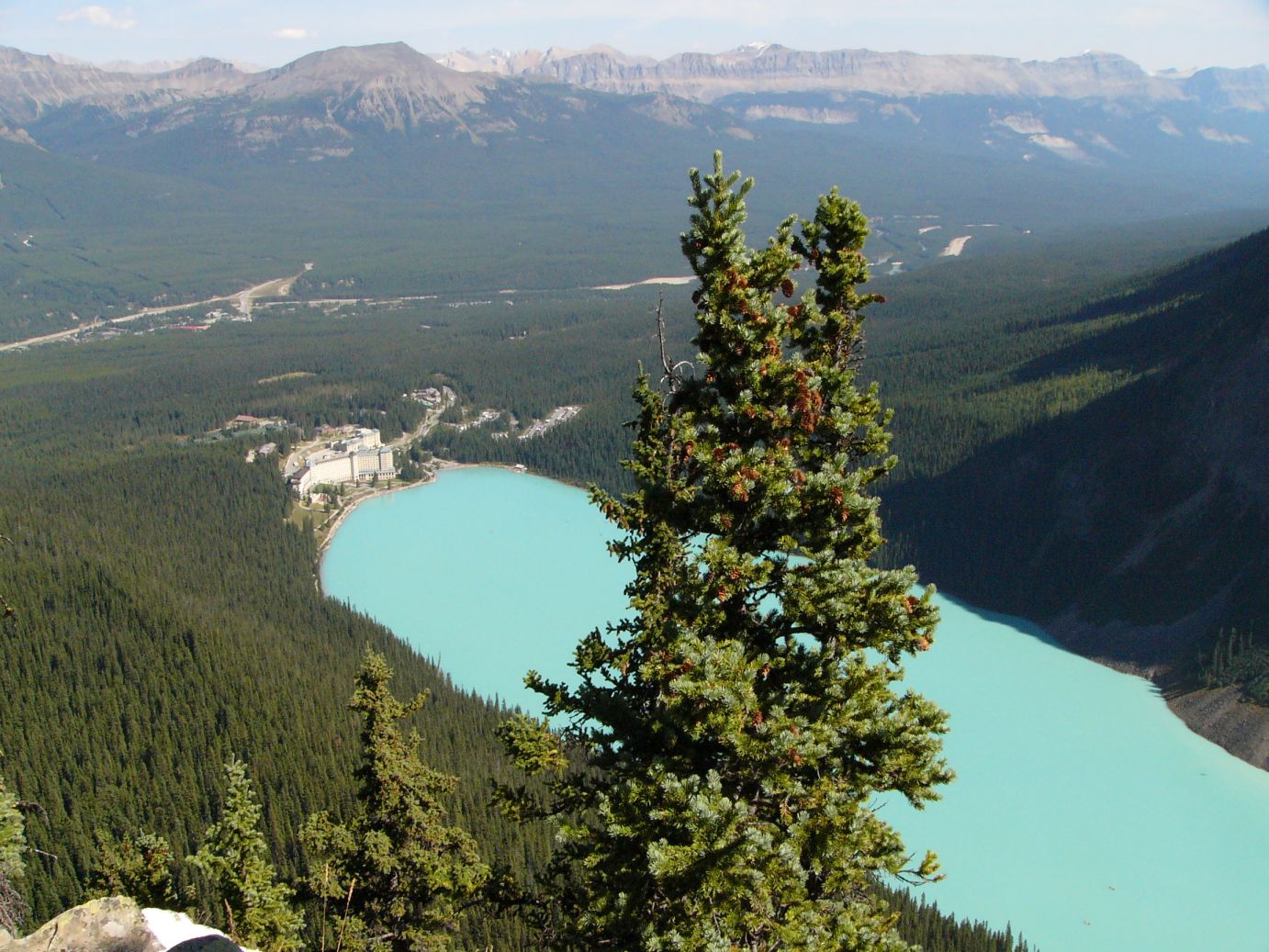 |
From the top of Big Beehive Mountain:
Lake Louise and the Bow River Valley
|
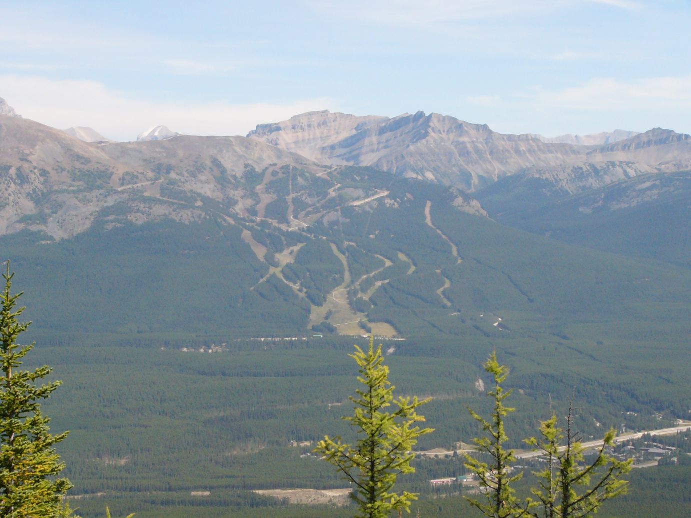 |
The Lake Louise Ski Area
as seen from the top of Beehive Mountain. The parkway lies in between on
the Bow River Valley.
|
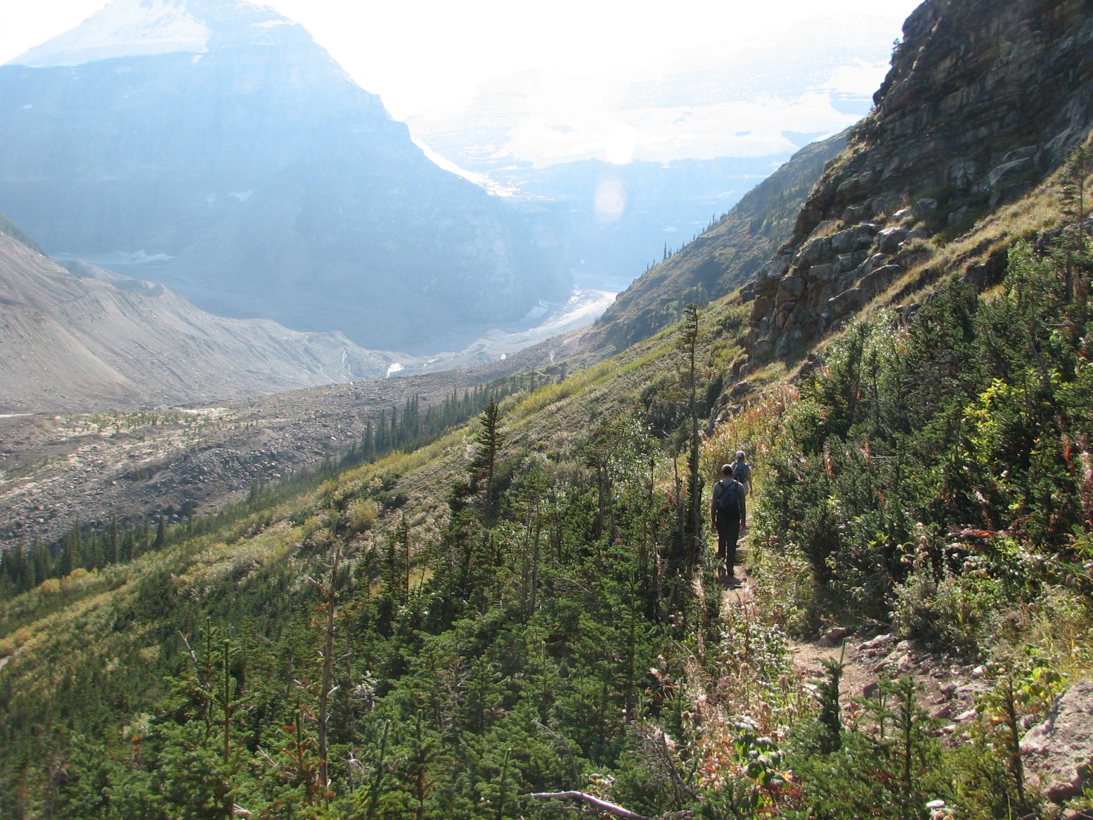 |
Plain of Six Glaciers Trail: Hikers walking towards Mount Victoria in the direction of the sun |
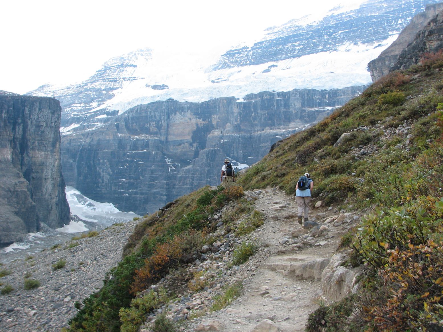 |
Weary legs near the last stretch with the Death Trap appearing towards the left. |
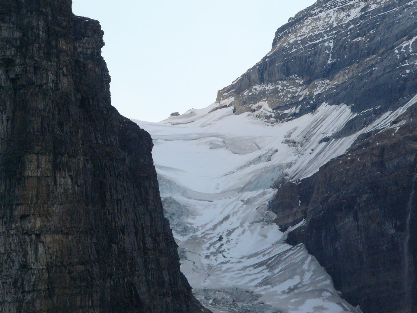 |
The Death Trap and Abbott Pass Hut |
 |
Glacial Moraine at the foot of Victoria Glacier |
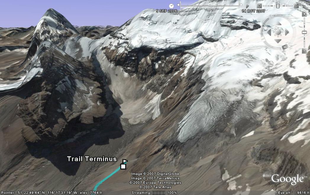 |
Google Earth view of Mount Victoria at the Trail Terminus |
 |
Google Earth view of the trail looking back from point of view of Mount Victoria. Lake Louise in the distance. |
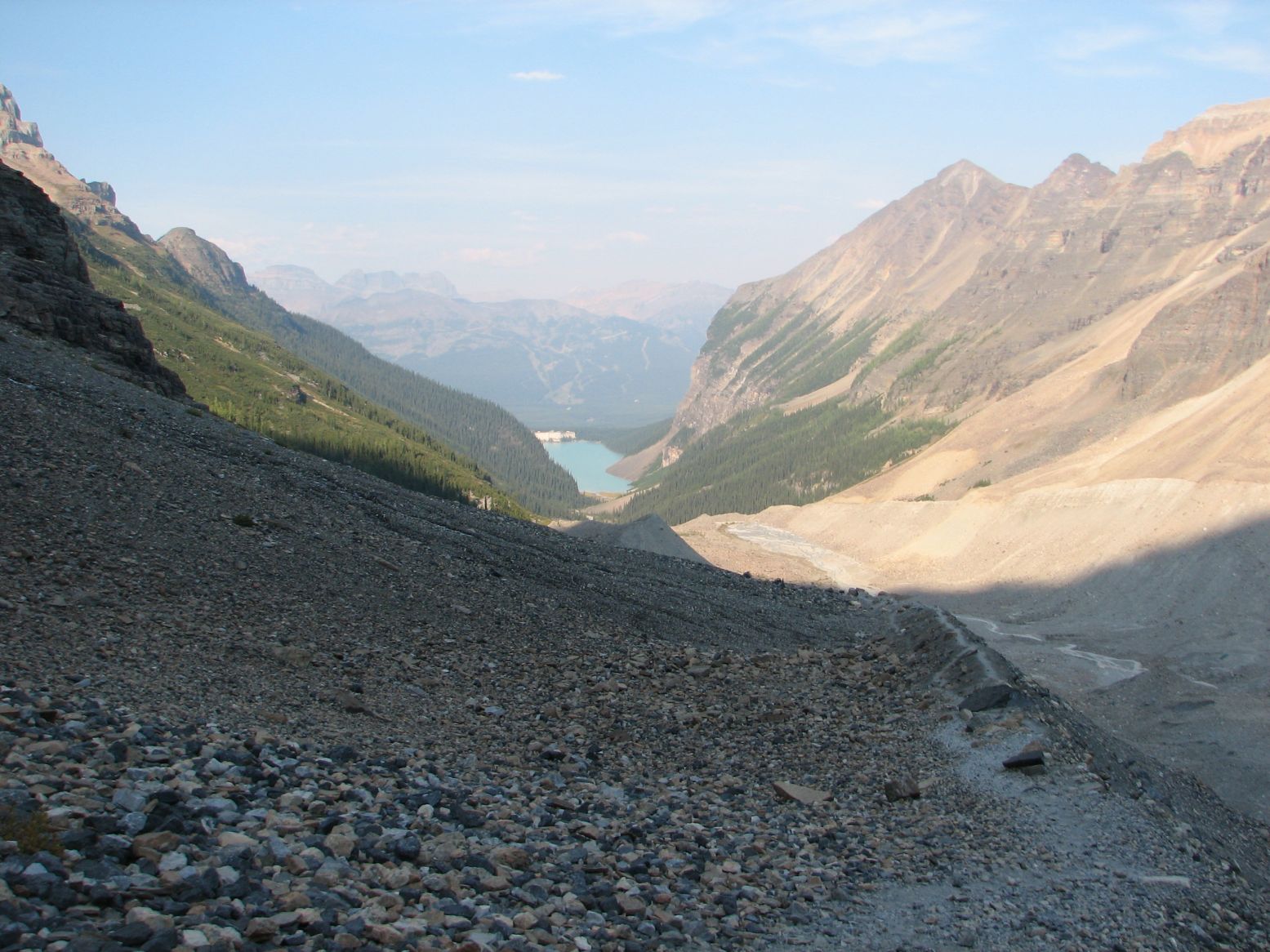 |
...and a photographic view of the same...Looking back at Lake Louise from the end of the trail |
Related links to the descriptions of the hiking trails...
http://www.onedayhikes.com/Hikes.asp?Hikesid=134
(Lake Agnes and the Beehives)
http://www.onedayhikes.com/Hikes.asp?HikesID=137
(Plain of Six Glaciers)
Click here for the full album of Day 4.
Photos & Text : Malini Kaushik & R. Venkatesh